Length & Difficulty: 4 km | 3 hours | Moderate
The Blackwater Creek Trail is part of the Duck Lake trail network just outside of Powell River. This particular trail is dotted with waterfalls, beautiful gorges, and bridges to walk along while winding through rugged rainforest. It is well suited for both hiking and mountain biking, so keep an eye out for other users of the trail. At about 4 km roundtrip, this is a great day hike that should take around 3 hours (leaving plenty of time to check out the waterfalls!). The tranquility of the rainforest only intensifies as you hike-- listen for the sound of the creek and waterfall. After about 25 minutes you will reach the breathtaking Kelly Falls. Don't forget your camera, this 20 foot waterfall is one you'll definitely want to capture. Kelly Falls boasts a campsite and picnic table, so take a break, have your lunch, and soak in the beauty.
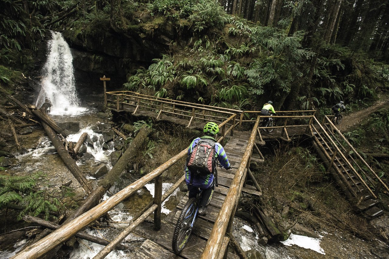
After a bite to eat, continue on the trail to your next waterfall destination, David Lam Falls. At about 60 feet, this waterfall is one of the tallest in the region. If you walk onto the viewing platform, get ready to feel the spray off the falls.
Directions to Trailhead:
Drive South of Powell River along Highway 101 until you reach Duck Lake Road on your left (across Garnet Rock RV Park & Campground). Drive up Duck Lake Road until you reach Burma Road Bridge at Duck Lake. Turn right at Burma Road and drive to the junction at Alaska Pine Road. Park your vehicle at the junction. Walk approximately 100 meters up Burma Road to the head of sweet water creek and black water creek trail heads on your left. Follow the trail to the “Y” and keep right. Staying on the railway grade will take you to a point where the trail leaves the grade going up a hill and over to the crest over looking Black water Creek. The trail takes you along the creek, down into the forge and across the bridge at Kelly falls. Turn left at the top of the crest on the opposite side of the creek. The trail continues on leading you to David Lam Falls and a picnic site. There is also a toilet at this site. From the picnic site the trail leads to Green Road (an old logging road). Turn left on Green Road and follow the road to washout creek. Turn left onto the trail following Washout creek. Walk past the bridge crossing Washout Creek (there is a toilet facility on the other side of the creek). Follow the old railway grade to where the trail begins of Burma Road.
The trails of the Sunshine Coast offer a wide array of experiences for travellers of all levels and walks of life. Ranging in length, difficulty, and experience, the trails on the Sunshine Coast are the epitome of the pristine beauty and epic landscapes of British Columbia.
Join the adventure and share your photos with us on Facebook, Instagram, Twitter, or YouTube using #sunshinecoastbc. Head here for more information on hiking routes on the Sunshine Coast.